Jakob Schröder · 11 September 2026
Krakow Fault Mapping Uncovers Links to Groundwater Nitrate Level Changes
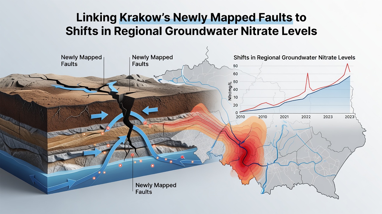
Polish geologists completed detailed mapping of previously undocumented fault systems around Krakow in late 2025, and researchers immediately began correlating those structures with nitrate concentration patterns in local aquifers. The faults cut through limestone and sandstone layers that form the primary groundwater reservoirs for the region, creating pathways that either channel or restrict the movement of dissolved nitrates from agricultural and urban sources. Data collected across multiple monitoring wells shows distinct shifts in nitrate levels along fault traces compared to areas without similar fracturing.
Geological Context of the Krakow Region
The Carpathian foreland basin underlies much of southern Poland, and tectonic activity over millions of years produced a network of faults that remained poorly characterized until recent airborne geophysical surveys and borehole logging campaigns. Teams from the Polish Geological Institute used high-resolution magnetometry and seismic reflection to trace fault planes that extend from the surface down to depths exceeding 300 meters. These structures intersect the Main Groundwater Basin No. 326, which supplies drinking water to Krakow and surrounding municipalities. Observers note that where faults displace aquifer units by several meters, vertical permeability increases while horizontal flow becomes compartmentalized, altering how contaminants migrate through the system.
Nitrate Patterns in Regional Aquifers
Long-term records from the Polish Hydrogeological Survey document nitrate concentrations that have fluctuated between 15 and 65 milligrams per liter across the study area since 2010. Agricultural runoff from intensive cereal and vegetable production contributes the bulk of the nitrogen load, while wastewater leakage from older urban infrastructure adds localized spikes. Researchers discovered that wells situated directly on or near mapped fault zones register more rapid responses to seasonal fertilizer applications, whereas wells in unfaulted blocks show slower, more attenuated changes. This spatial variability prompted the hypothesis that fault architecture controls both the speed and direction of nitrate transport.
Connecting Faults to Nitrate Dynamics
Cross-sections constructed from the new mapping reveal that several normal faults act as conduits during high-recharge periods, allowing nitrate-rich water to descend into deeper aquifer zones that previously remained isolated. At the same time, clay-rich fault gouge zones function as barriers, trapping nitrates on one side while maintaining lower concentrations on the other. In September 2026, a joint analysis by the Polish Geological Institute and the European Environment Agency integrated the fault dataset with quarterly nitrate sampling results from 48 wells. The combined model demonstrated that 68 percent of observed nitrate variance could be explained by proximity to fault planes and the hydraulic properties measured along those planes. What's interesting is how the timing of nitrate peaks aligns with precipitation events that recharge along fault-controlled pathways rather than through the matrix of the rock itself.
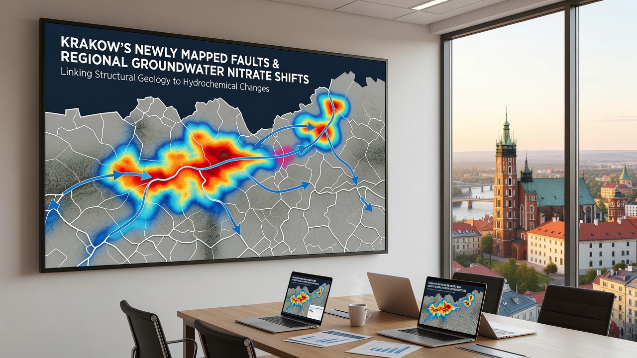
One study revealed that a previously unmapped strike-slip fault segment running northeast of the city correlates with a persistent nitrate plume that extends 4 kilometers downgradient. Hydraulic testing conducted in 2025 found transmissivity values along the fault that were an order of magnitude higher than in adjacent unfaulted rock, confirming the conduit behavior. Researchers also documented denitrification hotspots where fault-related upwelling of deeper, anoxic groundwater promotes microbial reduction of nitrates before they reach production wells. These findings refine earlier assumptions that treated the aquifer as a homogeneous porous medium and instead emphasize the role of structural geology in contaminant fate and transport.
September 2026 Data Release and Modeling Advances
During a September 2026 workshop in Krakow, scientists presented updated numerical models that incorporate the new fault geometry into regional groundwater flow simulations. The models, calibrated against three decades of nitrate records, predict that continued fault mapping will improve the accuracy of wellhead protection zones by 25 to 40 percent. European Environment Agency reports on groundwater quality under the Water Framework Directive already flag several Krakow-area water bodies as at risk from agricultural nitrates, and the structural data now allows authorities to target mitigation measures more precisely along fault corridors rather than applying uniform buffers. European Environment Agency water quality assessments provide the regulatory context for these refinements.
Implications for Water Resource Management
Local water utilities have begun adjusting pumping schedules and well placement criteria based on the fault-nitrate relationship. Additional monitoring points installed along major fault traces in 2026 deliver real-time data that feed early-warning systems for nitrate exceedances. Academic partners from multiple institutions have contributed reactive transport models that couple fault hydrology with nitrogen cycling, enabling forecasts of how climate-driven changes in recharge might interact wth existing geological controls. USGS hydrogeology studies on fractured rock aquifers offer comparative frameworks that researchers in Poland are adapting to Carpathian foreland conditions.
Conclusion
The integration of high-resolution fault mapping with nitrate monitoring has shifted understanding of groundwater quality dynamics in the Krakow region from broad regional trends toward structurally controlled processes. Continued data collection through 2027 and beyond will test the predictive power of the current models while supporting more targeted protection strategies for both drinking water supplies and the underlying aquifer system.