Nils Roth · 9 October 2026
Poland's Shifting Ground: Fault Lines Altering the Course of Subsurface Water and Contaminant Flow
Poland's tectonic features have drawn increasing attention from geologists and hydrologists who track how fault lines reshape underground water movement and the spread of pollutants, while data collected through October 2026 continues to refine models of these interactions. The country's geological structure includes several active fault zones that cut through sedimentary layers and influence aquifer connectivity across regions from the Carpathian foothills to the Baltic coastal plains.
Geological Framework of Polish Fault Systems
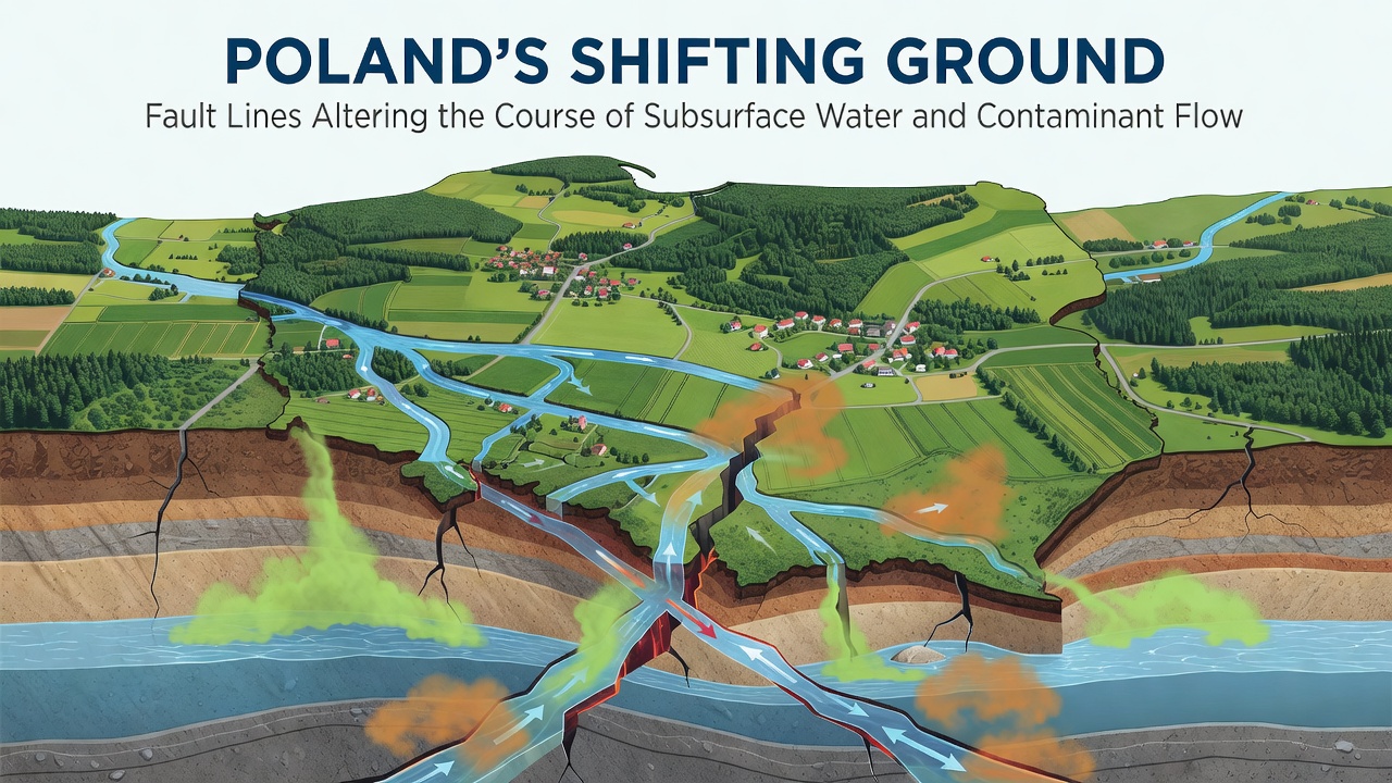
Researchers at institutions such as the Polish Geological Institute have mapped numerous fault lines that formed during different geological epochs and now intersect major groundwater basins, and these structures create pathways that either channel or block subsurface flows depending on their orientation and displacement history. Studies show that horizontal and vertical movements along these faults alter hydraulic gradients, which in turn redirect water from recharge zones toward discharge areas that were previously isolated. Observers note that the Sudetic Marginal Fault and the Holy Cross Fault represent two prominent examples where ongoing micro-seismic activity correlates with measurable shifts in piezometric levels recorded at monitoring wells.
Evidence from borehole logs and seismic surveys indicates that fault gouge and fractured rock zones often serve as preferential conduits for both water and dissolved substances, whereas impermeable fault cores can act as barriers that compartmentalize aquifers. Data from the European Environment Agency highlights how these dual roles complicate predictions of contaminant plumes in industrial areas near Katowice and Łódź, where historical pollution from mining and manufacturing has accumulated in shallow sediments.
Impacts on Subsurface Water Flow
Hydrological models developed by teams at Warsaw University of Technology demonstrate that even minor displacements along faults can change flow directions by several degrees, and such alterations affect travel times between recharge and extraction points. In the Upper Silesian Coal Basin, for instance, fault reactivation linked to mining subsidence has rerouted groundwater from deeper Carboniferous aquifers upward into Triassic layers, thereby modifying the chemical signature of water sampled at municipal supply wells. Long-term piezometric records reveal seasonal fluctuations amplified by these structural controls, particularly during periods of heavy precipitation when increased head pressures force water across fault planes.
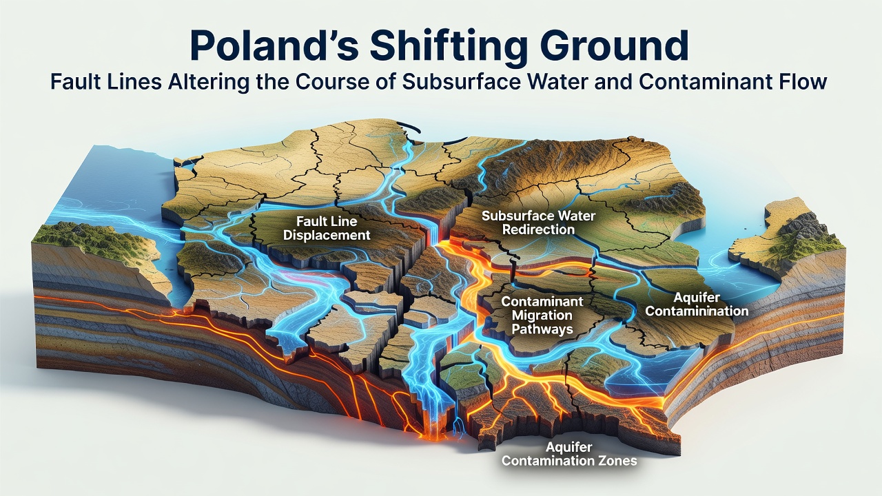
Groundwater dating techniques using isotopes such as tritium and carbon-14 further confirm that water crossing fault zones often exhibits mixed ages, indicating rapid vertical exchange that bypasses traditional stratigraphic barriers. This mixing pattern has been documented in multiple transects across the Carpathian Foredeep, where fault intersections coincide with springs that discharge water from disparate aquifer depths within short distances of one another.
Contaminant Transport and Migration Patterns
Contaminants introduced through agricultural runoff, industrial leaks, and legacy waste sites travel along fault-controlled pathways that accelerate their movement toward sensitive receptors such as rivers and drinking-water intakes, and monitoring networks operated by regional environmental authorities have detected elevated concentrations of nitrates, heavy metals, and hydrocarbons on the downgradient sides of major faults. In the Oder River catchment, researchers documented how a north-south trending fault system channels leachate from abandoned landfills directly into alluvial aquifers that supply nearby communities. The British Geological Survey has contributed comparative data from similar faulted terrains in other parts of Europe, showing analogous controls on plume geometry and attenuation rates.
October 2026 updates from Poland's national groundwater quality database incorporated new tracer tests performed across the Holy Cross Mountains region, revealing that certain fault segments now transmit volatile organic compounds at rates exceeding earlier estimates by 15 to 20 percent. These findings prompted adjustments to risk-assessment protocols used by local water-management agencies, which now factor fault proximity into siting decisions for new monitoring points and remediation wells.
Monitoring Advances and Regional Case Examples
Integrated geophysical and hydrochemical programs have expanded in recent years, employing electrical resistivity tomography and fiber-optic distributed sensing to detect subtle changes in subsurface conditions near active faults, and such technologies allow continuous tracking of fluid movement without repeated drilling. One study conducted along the margin of the East European Craton identified correlations between micro-earthquake swarms and short-term spikes in electrical conductivity within shallow wells, suggesting that fault slip events temporarily enhance permeability and mobilize previously stagnant water masses.
Case documentation from the Lublin Coal Basin illustrates how fault reactivation associated with longwall mining operations has redirected saline formation waters into freshwater zones, prompting regulatory adjustments that require operators to maintain buffer distances from mapped fault traces. Similar patterns appear in the Fore-Sudetic Monocline, where ongoing tectonic adjustments continue to influence the distribution of arsenic and fluoride in exploited aquifers.
Conclusion
Poland's fault networks exert measurable control over both the quantity and quality of groundwater resources, with recent observations through October 2026 underscoring the need for continued integration of structural geology into water-resource planning. Ongoing data collection from national and international partners supports refined predictive models that account for fault-induced flow variations, while remediation strategies increasingly target structural features that govern contaminant pathways. These developments provide a foundation for more precise management of subsurface environments across the country.